│By Gilberto Mazzoli, ESEH-Gale Fellow│
In 2024 I have been one of four recipients of the ESEH-Gale Fellowship in Digital Environmental Humanities. This fellowship has been a good opportunity to explore some aspects of my research in environmental history in a different way and helped to make my current research more visible.
This fellowship not only allowed me to access for seven months, numerous online Gale Primary Sources archives related to the environmental history of the United States and to experiment with tools contained in the Gale Digital Scholar Lab, but enabled me to develop a part of my research project related to the creation of digital interactive maps. This pushed me to learn new technical skills, like GIS, and to think differently about some aspects of my research in environmental history.
In this brief account I reflect on my first experience with digital humanities and on the challenges faced during my research.
Part 1. Collisions: Automobiles and the Environment in the United States
My current postdoctoral project in environmental history, entitled Collisions, explores aspects of early automobility in the United States, focusing on the interactions and encounters (including literal collisions) between humans, as automobile drivers, and the animal population.
For the ESEH-Gale fellowship I decided to take a short detour from my main project and focus on some peculiar aspects of it which would benefit from digital humanities tools, like mapping and GIS. I wanted to give a visual answer to the research question: in which ways did the rise of the automobile in the United States impact the practice of emerging ecological sciences and contributed to the production of environmental knowledge?
I identified two main and related areas of research: field science and roadkill. First, I focused on exploring how the practice of field scientists was affected by the rise of automobility. Automobiles allowed ecologists, botanists, zoologists, and geologists to reach places they could not reach otherwise, and in a shorter amount of time, thereby allowing new ways of measuring and observing the environment.
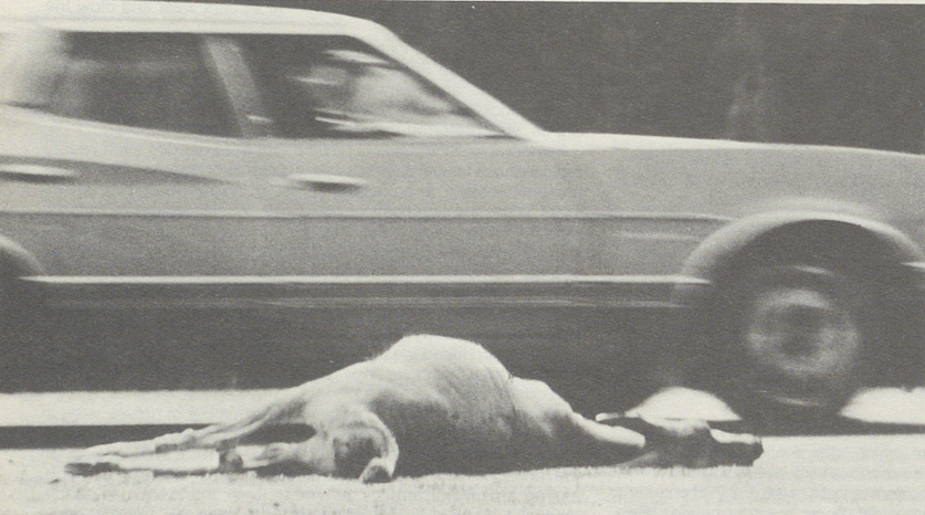
Second, the advent of the motorcar not only entailed new visual encounters between drivers and passengers and their surrounding landscapes but also caused the violent encounter of roadkill. What for tourists or amateur drivers became an (often tragic) opportunity to encounter animals, for natural scientists became a subject of research — and one that raised growing concerns about environmental protection.
Part 2. Researching Roadkill: Looking for a Word That Once Did Not Exist.
When I started the fellowship I had already collected some primary sources on roadkill and excited to explore some of Environmental History: Conservation and Public Policy in America, 1870-1980 and Smithsonian Collections Online, to dig into field reports and manuscripts from natural scientists like Joseph Grinnell and Frederic and Edith Clements. But I was aware that a problem could occur during these online searches.
According to the Oxford English Dictionary, the term roadkill only started to be used in the 1940s. The first use of this term was on the pages of the scientific journal Ecological Monographs in 1943 in an article by the zoologist Charles Yocom about the Hungarian Partridge in the Palouse Region, Washington state (Yocom 1943). Roadkill has occurred in the United States since the arrival of the automobile in the late nineteenth century. Before 1943, when the word did not exist, how did people describe it, and what traces did this leave in historical sources?
I needed to interrogate the primary sources to find which words (or group of words) were used to describe deadly collisions between automobiles and animals. I searched in digitised databases of scientific journals, with keywords or groups of keywords that could be related to the event, like “Animal” AND “Automobile” or “Animal” AND “Collision.”
Through this basic search I found scientific publications from the 1920s and 1930s in magazines like Science, The Wilson Bullettin, The Oologists, The American Midland Naturalist and others, where zoologists and natural scientists who researched roadkill prior to the alternative phrases in use described the event as “automobile and animal mortality” (Stoner 1929), “automobile and wildlife destruction” (Davis 1934), or “Wildlife Casualties on the Highway” (Stoner 1934).

Gale’s platform allowed me to use tools like “term frequency” to aid my research. With this tool you can see how many documents contain a certain term or word and their frequency through a selected time frame. However, as you can see the word roadkill never appeared in any of the documents contained in the Gale database in the selected time frame.
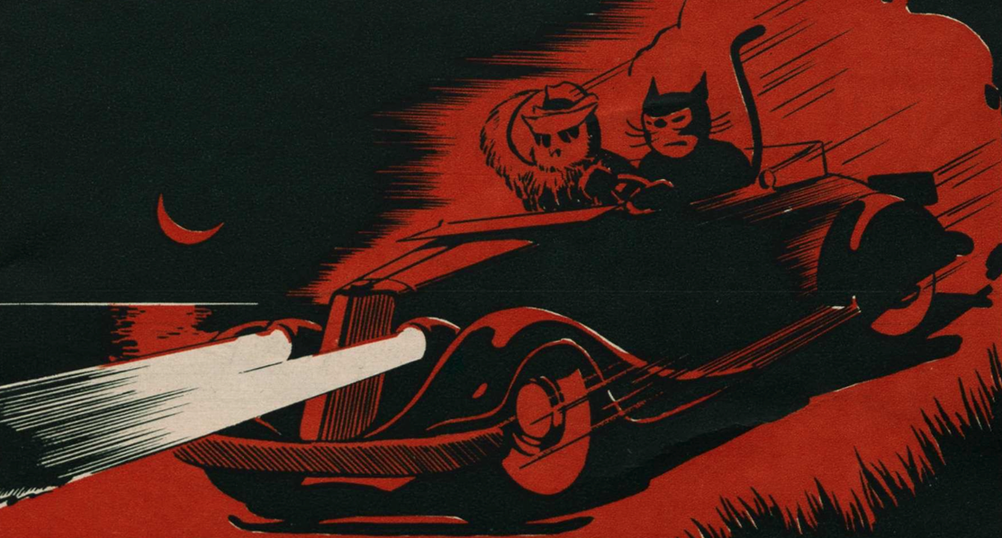
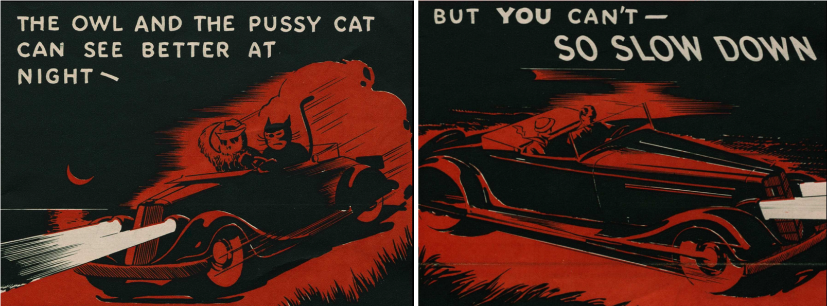
Even though the search into the sources did not give me the amount of material I hoped, it returned interesting visual material related to automobility, in particular from insurance companies. I made other attempts like this, using other keywords with few results and due to time constraints I had to begin to work on the next phase of the project.
Part 3. Collecting Roadkill: Organising the Data for Visualisation
The first step has been to organise the data contained in the primary sources about roadkill in a form that would allow me to visualise it on a map. I collected a monograph and 22 scientific papers about roadkill that span from 1924 to 1943 published in journals like Science, The Wilson Bulletin, The American Midland Naturalist, The Auk, the Journal of Wildlife Management, and the Ecological Monographs. These sources often contain information about the date and the path of the trip made, the species encountered, the typology of road and vegetation observed. However, such information is not consistent across the papers. The authors did not use the same methodologies, nor did they always describe their routes in detail.
A careful examination of these sources made me realise that the available data would only allow me to map the beginning and end points of the trips, along with a few stopovers. Creating a precise map, however, would be nearly impossible. Although these zoologists recalled their journeys with remarkable precision regarding time and mileage, from today’s perspective, how can I know exactly which roads they travelled? The simple answer is: I can’t.
In a few cases, I was able to gather information on the roads that existed at the time with the help of road atlases from the 1920s and 1930s, available through the David Rumsey Map Archive. Yet the main challenge remained: how could I create these maps without any prior knowledge of GIS? I approached this fellowship as an opportunity to learn basic skills on a platform called ArcGIS StoryMaps, as well as GIS more generally.
Part 4. Mapping Roadkill: Drawing a Trail Without Knowing the Path
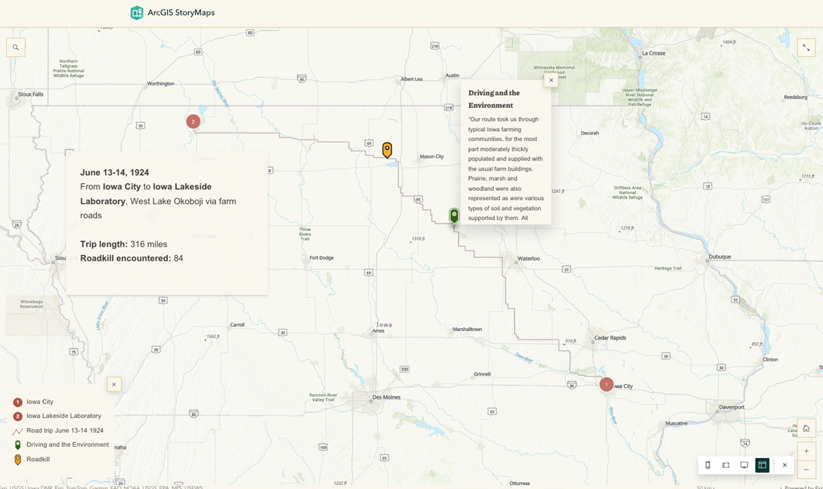
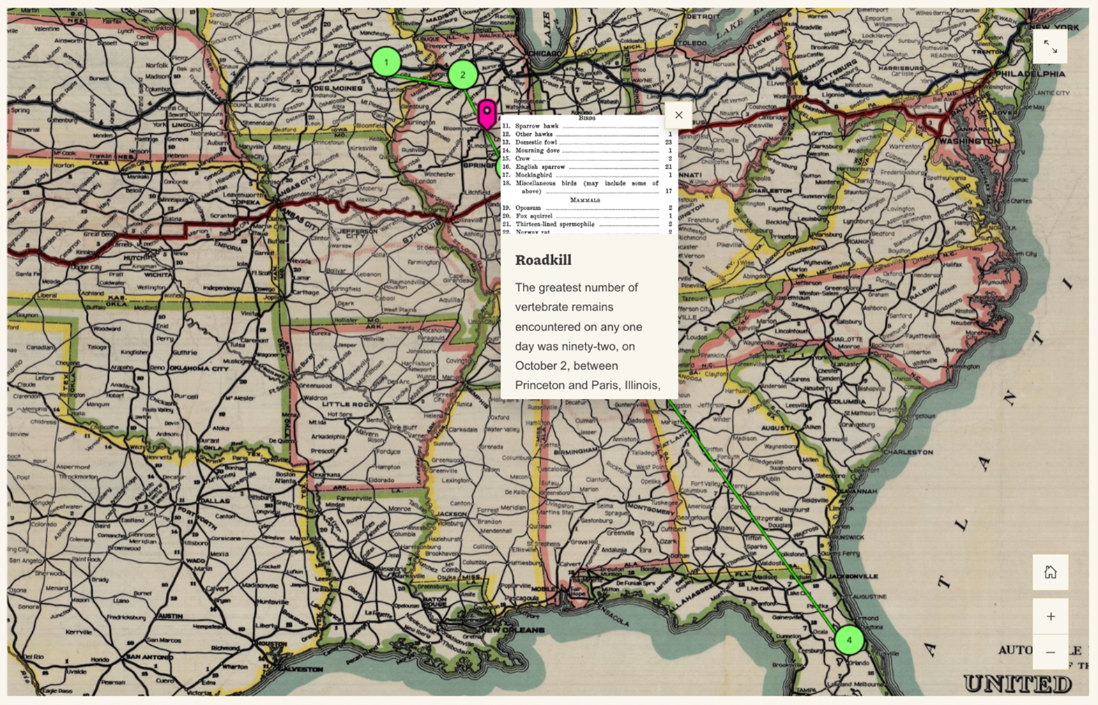
I began with ArcGIS StoryMaps. My first case study was based on the earliest paper on roadkill, published by Dayton Stoner in 1925 in Science. Between June and July 1924, Dayton Stoner and his wife, Lillian, drove from Iowa City to the Iowa Lakeside Laboratory and back, counting every roadkill they saw along the way. The article records all the species they encountered in detail.
I created my first map literally by hand, drawing with the mouse the route supposedly taken by the Stoners. I soon realised this was not the best method. I had assumed that once you input the start and end points, the software would automatically generate the route in between—like Google Maps—but that is not how it works.
To generate such a path, one must use other tools available in ArcGIS and then import the data into StoryMaps. Nevertheless, given the uncertainty surrounding the accuracy of these routes, I decided to abandon this type of hand-drawn mapping in favour of creating a more minimal but historically accurate layout.
So, I wondered: what if, instead of drawing the full paths of these road trips, I mapped the locations mentioned in the primary sources and connected them? The result is an interactive map, more akin to an infographic, which can also be layered over a historical road map as a background. I did not completely abandon StoryMaps, however: I continued developing the case study on Dayton Stoner, adding more details, and made it available online, here).
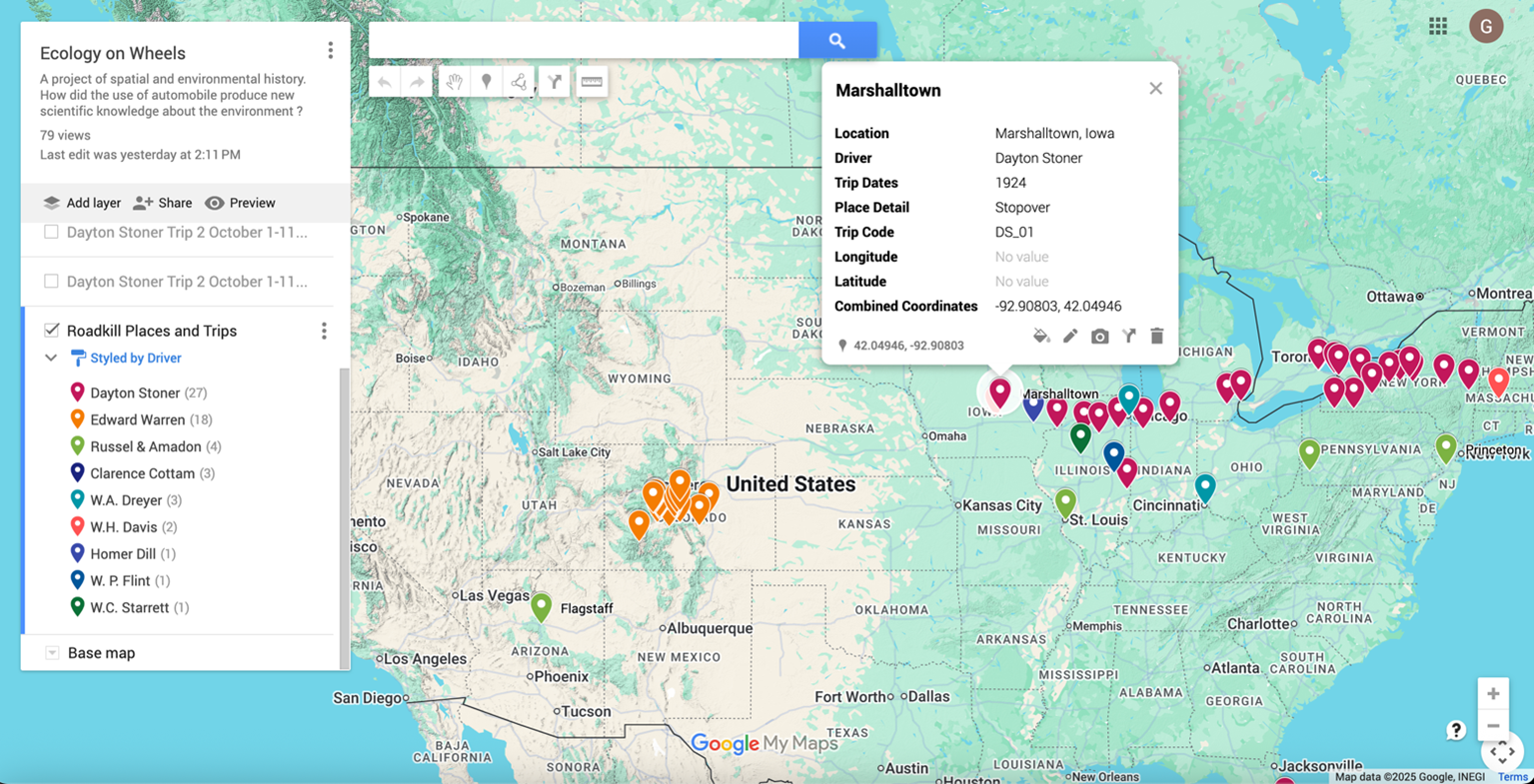
To pursue this task, I experimented with Google My Maps, which required a more structured workflow. First, I organised some of my data into two Excel tables. The first table lists the town name, location, driver’s name, year of the trip, starting point, arrival point or stopover, and coordinates. Then, I assigned each trip a code that refers to another table, where I added additional details—when available—such as the month and day of the trip, route, mileage, number of roadkill, and type of road. Lastly, I imported the first table into Google My Maps. When mentioned in the sources, I added to the map the towns that were crossed or the roads that were used.
The resulting map displays all the locations mentioned in the scientific publications about roadkill, organised by driver. Hovering over a location’s label reveals more information, such as the driver’s name, the year of the trip, and whether the place served as a starting point, destination, or stopover. To create the infographic, one final step was needed—“connecting the dots”—but this required another platform, such as the applications offered by ArcGIS. Even if not yet complete, this interactive map already shows the number of miles travelled across the United States by these naturalists documenting roadkill.
Conclusion: Dealing with Absence
One of the most challenging tasks for historians is learning how to deal with the absence of primary sources. I emphasise the word learning because this is an experience every historian must face at some point in their research. Sometimes, such absences lead your work away from its planned path; at other times, they compel you to tell a different story altogether. In any case, they always prompt you to reflect on your research from an unexpected perspective—because absence, too, is part of the research process.
This project is not yet complete, but it will continue to evolve in the coming months. This fellowship has offered me a valuable opportunity to engage with mapping tools and to begin rethinking how digital methods can contribute to historical research.
If you enjoyed reading about digital humanities and roadkill, check out these posts:
Blog post cover image citation: Travelers’ Ins. Company. You Bet Your Life! The Travelers Insurance Company, 1937?. Public Health Archives: Public Health in Modern America, 1890-1970, https://link.gale.com/apps/doc/AETBXO626411113/PHIA?u=webdemo&sid=bookmark-PHIA&xid=b57fc4f1&pg=17